Background
Baringo county is situated in former Rift valley province. The County borders Turkana and Samburu to North, Laikipia to East and West Pokot to the West. The County covers an area of 11,015.3Km2 with a population of 555,561 (population census 2009) of which 279,081 are male and 276,480 are female consisting of 103,734 households KNBS (2013)
The county is classified as arid and semi arid. Most parts of East Pokot, Baringo Central, Baringo North, Mogotio Districts are arid and semi arid. The temperatures range from a minimum of 10°C to a maximum of 35°C in different parts of the county. The rainfall varies from 1,000mm to 1,500mm in the highlands to 350mm to 600mm per annum in the lowlands. The dry seasons are in the months of january, february and March, Long rains in April, May, June and July and the short rain seasons are in August, september, October and November
County Agro-Ecological Zones
| Zone | County Sub-Region |
| LM5, &6 | Kollowa,Churo, Salawa,Barwessa |
| LH2, UM4& LM3 | Along the Tugen hills zone |
| Tropical Alpine (UH:LH:LM1) | Mumberes, upper Eldama Ravine and Torongo |
Baringo County has six Sub-Counties namely, Baringo central, Baringo North, Marigat, Tiaty, Mogotio and Koibatek. The county is made up of six Sub counties namely: Mogotio, Eldama Ravine, Baringo South, Baringo Central, Baringo North and Tiaty. The Sub counties are further divided into 30 wards.
The project is livestock based and will address issues of enhancing pastoral livelihoods resilience. Among other things the project will address problems of water availability for pastoralists, markets for livestock and products, livestock diseases, resource based conflicts and alternative livelihoods.
Cattle rustling in the area has always been resource based (Pasture and Water).The project will invest in peace building initiatives to end cattle rustling, pasture development as well as water infrastructure development and rehabilitation.
Achievements under thematic areas
Toggle content goes here, click edit button to change this text.
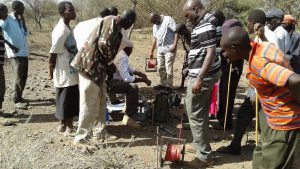
1. Kipsogon/Mogotio borehole (New water resource)
Location Mogotio Sub County Mogotio Ward Kipsogon Village
Latitude 0.03561 Longitude 35.95346
start date 01/10/2016 Completion date 19/11/2018
Beneficiaries male 2051 female1988
Yield 8m3 /hr
2. Ng’aratuko/Ng’osuonin borehole (New water resource)
Baringo North Sub county Kipsaraman Ward Riron/Ng’osuonin Village
Latitude 0.71147 Longitude 35.96549
Start date 01/10/2016 Completion date 19/11/2018
Beneficiaries Male 1294 Female 1434
Yield 2m3 /hr
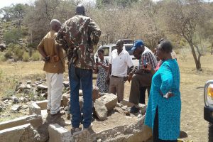
3. Ngaina/Taparara water pan (New water resource)
Tiaty sub county Tirioko Ward Taparara Village
Latitude 1.46686 Longitude 35.77391
Start date 01/10/2016 Completion date 30/5/18
Beneficiaries Male 1600 Female2890
Yield 23,275 m3
4. Burtum Water pan (New water resource)
Baringo North Sub County Saimo Soi Ward Bartum Village
Latitide 0.71305 Longitude 36.09416
Start date 08/01/2018 End date 06/02/2021
Beneficiaries Male 1678 Female 2322
Capacity 23,275 m3
5. Lelmen Hay shed (Fodder conservation)
Baringo Central Sub County Kabarnet Ward Lelmen Village
Latitude 0.54771 Longitude 35.64767
Start date 01/01/2017 Completion date 19/11/2018
Beneficiaries Male 1250 Female 1193
Capacity 25,000 Bales
6. Kamar Hay shed (Fodder Conservation)
Mogotio Sub county Emining Ward Kamar Village
Latitude 0.24773 Longitude 36.01251
Start date 10/09/2019 Completion date
Capacity 10,000 Bales
Toggle content goes here, click edit button to change this text.
Toggle content goes here, click edit button to change this text.
Toggle content goes here, click edit button to change this text.
Toggle content goes here, click edit button to change this text.